

NATHAN STONE
Searching for Halifax’s earliest defenses underfoot at RA Park
By Nathan Stone,
Trident Staff
ARCHAEOLOGY IN ACADIE FACEBOOK
A Saint Mary’s University archaeologist is searching for the remains of some of Halifax’s earliest defensive structures in Royal Artillery Park
Archaeology and colonialism professor Dr. Jonathan Fowler presented “The Historical Archaeology of Halifax’s Earliest Defenses,” a lecture focusing on the location of the city’s old town wall and perimeter forts to the Royal United Services Institute of Nova Scotia (RUSI(NS)) at RA Park in April.
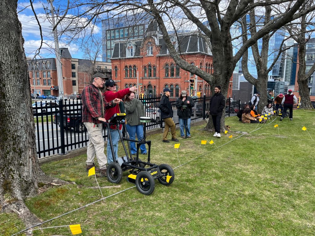
The lecture was followed by an investigation during which Fowler and a team of students searched the grounds of RA Park for evidence of those defenses.
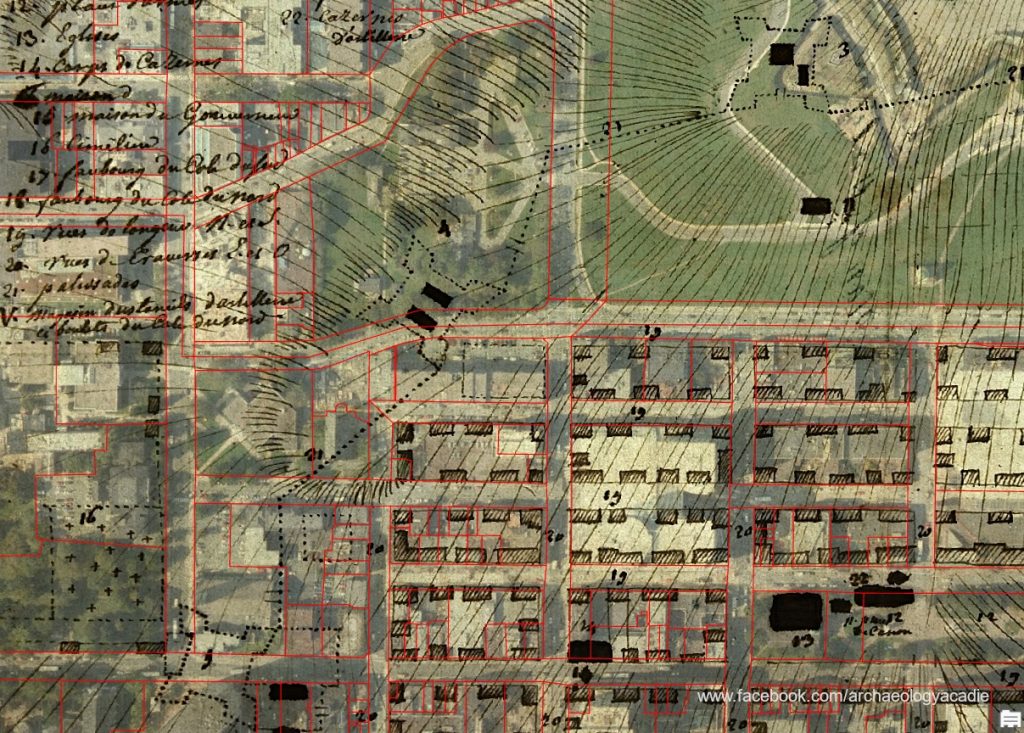
The town wall stood from 1749 to 1763 to protect Halifax’s land perimeter. It was constructed from wooden stakes and featured five small forts along its length. The exact locations of the walls and forts have been lost to time, but Fowler’s research suggests evidence of these fortifications may still exist underneath RA Park.
Fowler noted during the presentation that he’s not the first person to search for the precise location of the old defenses. An attempt was made in 1959, but modern technology allows him to go beyond the bounds of earlier investigations. He described his work on the subject as time intensive and iterative.
“You take a few steps and consider the results, then take a few more steps and consider those results.”
Using advanced map-analyzing software known as Geographic Information Systems (GIS), Fowler has combined several maps of early Halifax with satellite imagery to theorize the location of the city’s early walls and forts. The software stretches an old map over top of a modern picture of the area using streets present on both images as anchor points.
The GIS maps created a starting point for Fowler and suggested that parts of the town wall and one of the forts may be buried under RA Park. Fowler said that since early maps of Halifax were drawn by hand, there are noticeable discrepancies in the scale and position of the city’s defenses.
The old wall and forts cut through much of what is now downtown Halifax, but Fowler says there’s very little chance of finding evidence anywhere except RA Park as other potential locations have been subjected to heavy construction or have been paved over.
Fowler and a team of anthropology students from St. Mary’s spent three days at the end of April examining the ground under RA Park, scanning for traces of the old defense network without excavating or otherwise disturbing the site.
Joanna Cochrane is a 3rd year anthropology student on the team. She assisted with the remote sensing operation. Speaking while on site, she said remote sensing equipment can indicate that something of interest may be underneath the ground, but the results must be studied before the team can conclude.
“Once we go back to the lab, we’ll be able to compare the data to historical records and see if there’s something significant.”
The team ran their radar platforms over the site in a grid pattern to record as much data as possible. If Fowler’s team successfully finds evidence of the early fortifications, he said it will provide an anchor point that will help to accurately map those defenses.
By searching for the city’s lost fortifications, Fowler said he hopes his research will make a meaningful contribution to 275 years of Halifax history.
“I think we’ve got the potential to tell some stories that are fresh and new.”